The Netherlands is a country that is famed for its windmills, tulips, delicious breakfasts, great beer, and its people’s relaxed and unusual ways. On a purely economical basis, the Netherlands is also widely recognized as the second-largest exporter of food and beer in the world. There is, however, one aspect of the Netherlands that is often mistaken, and this has something to do with its name.
There are many people who still refer to the Netherlands as Holland, but did you know that it’s actually a complete blunder and that the Netherlands and Holland are two different places? The Netherlands is the actual name of the country, while Holland is a geographical location within the same country. With this information, it should be called the Netherlands instead of Holland.
The misconception that Holland is synonymous with the Netherlands is understandable, given the country’s complex history of name changes. Over the years, the region has been known as the Dutch Republic, the United States of Belgium, and the Kingdom of Holland. However, the confusion surrounding the country’s name isn’t solely due to its historical complexities.
Provinces of Netherlands
1. Groningen

Since the 13th century, Groningen has been known as a center for talent, free thinking, and new ideas. It has been the economic, academic, and political powerhouse of the Northern Netherlands. The city is famed for its old university that has been around for a long time. Over the past 400 years, the University of Groningen has grown to be one of the biggest universities in The Netherlands with over 50,000 students.
2. Drenthe

Drenthe is a province in the Netherlands located in the northeastern region of the county. The region has a long history of small-scale businesses, like spinning, weaving, and making rope. As one of the most sparsely populated provinces in the Netherlands, Drenthe is known for its abundant forests and extensive rivers.
The main economic activity is agricultural processing, which includes the production of potato flour and strawboard. The region’s two largest cities, Assen and Emmen, are the main centres for industry, while the rest is devoted to agriculture.
3. Overijssel

Overijssel is a province of the Netherlands that is located to the South of Drenthe in the central-eastern part of the country. Its capital city is Zwolle, which boasts a rich history, but the town of Enschede takes the crown for being the province’s largest city.
Several picturesque natural preserves can be found in the province, including De Weeribben. Overijssel is now heavily populated with active industries and services, despite having many beautiful natural reserve parks.
4. Gelderland

The history of the Gelderland region in the Netherlands dates back to the time of the Holy Roman Empire. Arnhem is the capital of the province, while Nijmegen is the largest city, covering a total area of 5,136 square kilometres.
The province is also home to approximately two million people and is known for its historic cities, large rivers, forests, and many rural areas. It is named after the nearby German town of Geldern, which is known for its famous dragon legend. Despite being one of the largest provinces in the country, Gelderland is also known to have the lowest population density.
5. Limburg

Limburg is a province located in the southernmost region of the Netherlands. Its capital and largest city is Maastricht, which covers a surface area of 2,209 square kilometres. The province of Limburg is a major player in the Dutch wine industry. South Limburg has the highest concentration of vineyards in the whole Netherlands.
Another noteworthy aspect to mention is that Limburg shares borders with both Germany and Belgium, whereas the provinces of Gelderland and North Brabant are located in the northern region. The name Limbourg comes from the castle town of Limbourg, which is now part of Belgium.
6. North Brabant

North Brabant is a province of the Netherlands located in the southern region of the country. The capital is Hertogenbosch, and the largest city is Eindhoven, which has an area of 5,082 square kilometres. The region is bordered by Belgium’s provinces of Limburg and Antwerp, and the Meuse River is just north of the province. Today, North Brabant is among the most populous provinces in the Netherlands, with prominent cities such as Den Bosch and Eindhoven residing within its borders.
7. Zeeland

Zeeland is a province in the Netherlands located in the south-western region of the country. Middelburg is the capital of the province, and Terneuzen is the largest city with a surface area of 2,933 square kilometres. The province, also known as “sea-land,” comprises numerous tiny islands surrounded by a narrow strip of land that extends across the border with Belgium. Zeeland is also renowned for its traditional oyster culture and shrimp and mussel fisheries, as well as its seaside resorts.
Tourism holds a significant role in the economy of the province, as the local beaches are transformed into tourist hotspots during summer. Zeeland is a popular destination for German tourists because of its beautiful weather and fascinating beaches.
8. Friesland

Friesland province is located on the mainland that also includes the West Frisian islands of Ameland, Vlieland, Terschelling, and Schiermonnikoog. Its capital and largest city is Leeuwarden, which has a surface area of 5,749 square kilometres with a total population of 646,874.
Friesland is a special part of the country because the people there speak a special language called Frisian. The province is primarily an agricultural region and is home to the Frisian Cattle and black Frisian Horse. Agriculture and tourism, especially on the lakes and the islands in the Wadden Sea, are important sources of income. The province is also well-known for its ice skaters and the Elfstedentocht (Eleven Cities Tour), a 200-kilometre ice skating race.
9. Flevoland

The province of Flevoland is the youngest of all the provinces in the Netherlands. Flevoland, which was established in 1986, is located in the central region of the country, on the former Zuiderzee bay site. Lelystad is the capital and Almere is the largest city, covering a total area of 2,412 square kilometres and having a population of 407,818. This agricultural region is characterized by a predominantly flat terrain. The region was formed almost entirely through the process of reclaiming land, and today, the city of Almere is situated there.
Another thing to remember is that Flevoland has its own national park, the Nieuw Land national park. The park comprises four areas of natural beauty: Oostvaardersplassen, Lepelaarplassen, Marker Wadden, and Markermeer. This park is the largest artificially created natural area in the world.
10. Utrecht

The province of Utrecht has a large population, even though it is small. The city of Utrecht, which bears the name of its capital city, is located in the eastern region of the Randstad conurbation. Its capital and largest city is Utrecht, which has a surface area of 1,449 square kilometres and a population of around 1,284,504.
The city of Utrecht is the fourth-largest in the country and was founded by the Romans in the year 47 a.D. Known as the religious center of the Netherlands, this ancient city features many buildings from the Middle Ages.
Utrecht also has Utrecht University, the biggest university in the Netherlands, as well as several other higher education institutions. Due to its central location within the country, it serves as a significant hub for both rail and road transportation, and boasts the busiest train station in the Netherlands, Utrecht Centraal.
11. Noord (North) Holland

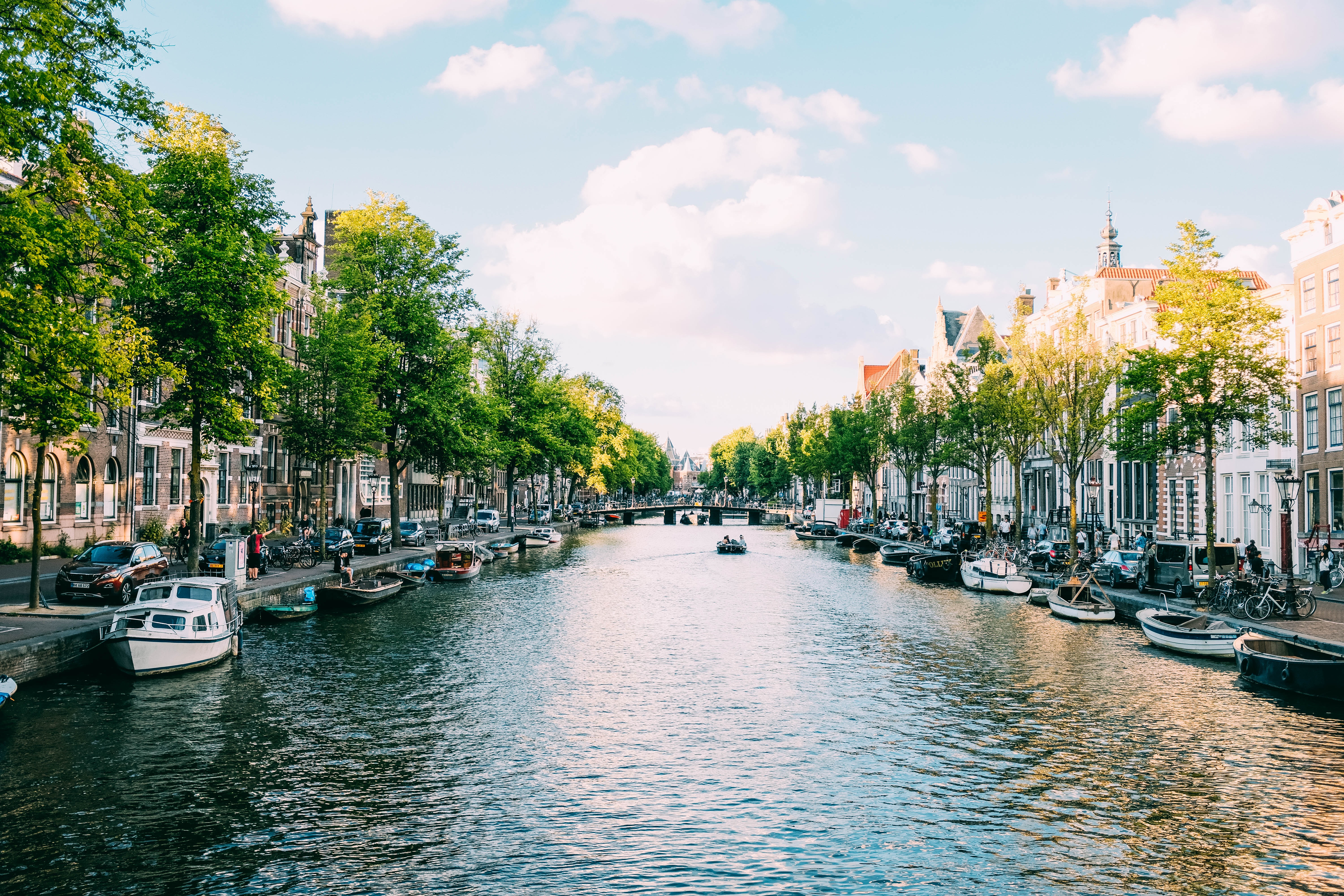
The province of North Holland is located in the western part of the country. Its capital city is Haarlem, and the largest city is Amsterdam, which encompasses a total area of 4,091 square kilometres and has a population of 2,809,483.
The province is home to the country’s most famous city, Amsterdam. Due to its many museums and historical monuments, the capital city of Haarlem also attracts many tourists each year. This area is usually Dutch and has canals and windmills, which is why a number of historic Dutch villages can also be found in North Holland. Their inhabitants still adhere to the same lifestyle as their ancestors did during the 16th century.
12. Zuid (South) Holland

The province of South Holland is located in the western part of the Netherlands, along the North Sea. The capital is The Hague, and the largest city is Rotterdam, which has a surface area of 3,418 square kilometres. South Holland boasts a population of 3,650,222 individuals.
South Holland, the most populous province of the Netherlands, offers a multitude of amenities beyond the bustle of cities such as The Hague and Rotterdam. This province situated on the North Sea is awash with historical, cultural, natural, and architectural treasures. The province is not only a highly regarded tourist destination, but it also happens to be one of the most densely populated and industrialized regions in the world.
Having this knowledge in mind, when you refer to the Netherlands as Holland, it’s more like referring to the United States as Dakota, which has both a northern and a southern region. However, in contrast to the Dakota region, which is predominantly uninhabited, the Holland provinces (north and south) are the most populous and possess some of the most prominent attractions, such as Amsterdam and Keukenhof.
When you hear the word Holland, it’s important to find out if it’s the northern or southern part of Holland because there are actually two types of Holland: Noord (North) Holland and Zuid (South) Holland.
More interesting facts about the Netherlands
Another thing to remember is that in Dutch and English, people who live in Holland call themselves Hollanders. This applies only to people from Noord Holland and Zuid Holland. Whereas everyone else in the country is referred to as Dutch, although you would say in Dutch Nederlanders. The term “Dutch” can also be used to describe the official language of the Netherlands.
In Dutch, there is a saying that goes like this: “Nederlands Sprekende,” which when translated to English sounds like they would prefer to be called Nederlanders who speak Dutch. The neighbouring nation of Germany has a similar expression that reads as follows: “Deutsche Sprechen Deutsch in Deutschland,” which merely suggests that they would prefer to be referred to as Germans. This linguistic ambiguity is the reason why some Americans refer to the Pennsylvania Dutch as Dutch, despite their German heritage.
The Netherlands is a part of the Kingdom of the Netherlands, which is headed by the Dutch royal family. This makes it even more complex. The Kingdom of the Netherlands is composed of four constituent countries, such as the Netherlands, Aruba, Curaçao, and Sint Maarten. To find three of those countries, you need to first cross the frigid North Sea to the Caribbean and then go to Aruba, Curaçao, and Sint Maarten.
Keep in mind that these countries are not simply part of the Netherlands, but are independent countries with their governments and currencies. While Aruba and Curaçao may appear to be islands, Sint Maarten is only the southern half of a tiny island named Saint Martin, which is also occupied by France. Although they’re separated from the rest of Europe by the Belgian border, these Netherlands and French territories have a border on an island in the opposite direction.
How the Dutch influence was felt in different parts of the world
But why did the Kingdom of the Netherlands enter the Caribbean region? This is because those countries were once part of the Dutch Empire. Dutch merchants, constantly seeking ways to expand their business, extensively explored every valuable port during the 1600s. In the past, the Caribbean islands had numerous resources that the Dutch could sell to make money. These items included corn, sugar, cotton, tobacco, indigo, salt, coffee, oil, and slaves.
Because these items were of great value back then, the Dutch colonists decided to start profitable businesses that included the buying and selling of indigenous people. This was known as the slave trade on the Caribbean island.
In addition to the Caribbean and Europe, the Kingdom of the Netherlands also had influences in other parts of the world. The eastern part of the United States was often referred to as the ‘new Netherlands,’ and its capital city was known as ‘Amsterdam,’ a reference to the ‘new Netherlands’. They were present in New Zealand as well, and within its vicinity was the king of the islands, known as New Holland.
Despite the end of the Dutch colonial era, the Caribbean islands of Sint Maarten, Curaçao, and Aruba remain sovereign nations. Although the influence of the Kingdom of the Netherlands in four countries within a single kingdom is not uncommon, it extends beyond that, as the Netherlands also has three public bodies located in the Caribbean Sea. These islands include Bonaire, Sint Eustatius, and Saba.
Note that these islands are not sovereign countries in the Kingdom of the Netherlands, but cities in the country called the Netherlands. The distinctive feature of these islands is that they are distinct municipalities within the Netherlands. Bonaire, St Eustatius, and Saba are ruled by their island governments and by the Dutch central government. But unlike normal municipalities, these islands don’t belong to the Dutch province.
Despite not belonging to the Dutch territory, residents of Bonaire, St. Eustatius, and Saba participate in Dutch government elections, much like those of any other Dutch person. Since they aren’t part of a Dutch province, they don’t use the Dutch currency of euros, opting instead for the US currency. The situation resembles that of Hawaii. Hawaii, although a state in the Western United States, utilizes a currency similar to the Japanese Yen.
These cities and island nations in the Netherlands and the Kingdom of the Netherlands are called the Dutch Caribbean, and their citizens are called Dutch citizens. The Dutch Caribbeans are European citizens because the Kingdom of the Netherlands is a member of the European Union.
So, Ultimately, there are 6 Caribbean islands belonging to the Kingdom of Netherlands
- Aruba
- Curaçao
- Sint Maarten
- Bonaire
- Sint-Eustatius
- Saba
There are 4 countries under the Kingdom of Netherlands
- Aruba
- Curaçao
- Sint-Maarten
- The Netherlands
There are 12 Provinces in the Netherlands
- Groningen
- Drenthe
- Overijssel
- Gelderland
- Limburg
- Noord-Brabant
- Zeeland
- Friesland
- Flevoland
- Utrecht
- Noord (North) Holland
- Zuid (South) Holland
There are 2 Holland Provinces
- Noord-Holland
- Zuid-Holland
One Kingdom
- Kingdom of the Netherlands
All of which are still considered Dutch.
Sources
Mappr: Provinces of the Netherlands
Netherlands Tourism: Provinces of the Netherlands
Photo by Adrien Olichon on Unsplash
Leave a Reply